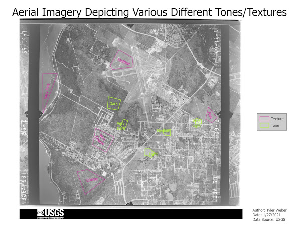
It is a new semester and a new year for learning more about GIS! In this week's lab, I explored and re-learned how to create a feature class, as well as creating polygons and points for different exercises I needed to complete. For the first exercise, we needed to distinguish the different types of tones and textures that were on the aerial image supplied. One big struggle I had was making sure the polygons I was creating were not messed up and an even bigger struggle was getting the labels to line up in the way I wanted them to. It took many attempts but I finally fixed it, and below this is how the map turned out! It's not the best-looking map but you hopefully get the idea of what it's trying to depict.
For our second exercise, we looked at an aerial image of Pensacola Beach from 1970! It's really crazy to see the change from 1970 to today. The point of this exercise was to create points for shape and size, shadows, patterns, and association. Shape and size are like when features are distinguishable by their shape and size from the air, pretty self-explanatory. Patterns are features that are distinguishable only by certain patterns they have, for example, the water can be seen by the patterns of the waves that can be seen. Association is like when you can tell what a feature is by the building or other features that surround it. Also, shadows are pretty self-explanatory as well. But besides those, it was pretty much like the first exercise in creating a feature class, but the only thing that changed was the geometry being a point instead of a polygon. It was pretty fun to make and here is how it turned out!
Tune in next week for the next addition to Tyler's GIS blog!


