Hello everyone,
In this week's final edition of the GIS Programming blog series, we explore "Working with Geometries". I am sad to see this class ending, but I have taken so much away from it, I can't wait to dive even deeper into programming with Python. Some learning outcomes we were expected to take away from this course include being able to create a search cursor to iterate over shapefile geometries, demonstrate the ability to write vertices of a geometry to a text file, and then contrast the different objects using parsing over geometries within a script. At this point of the course it seemed pretty straightforward, so here is the flow chart that breaks down the process to reach the outcome in the screenshot below the flow chart:
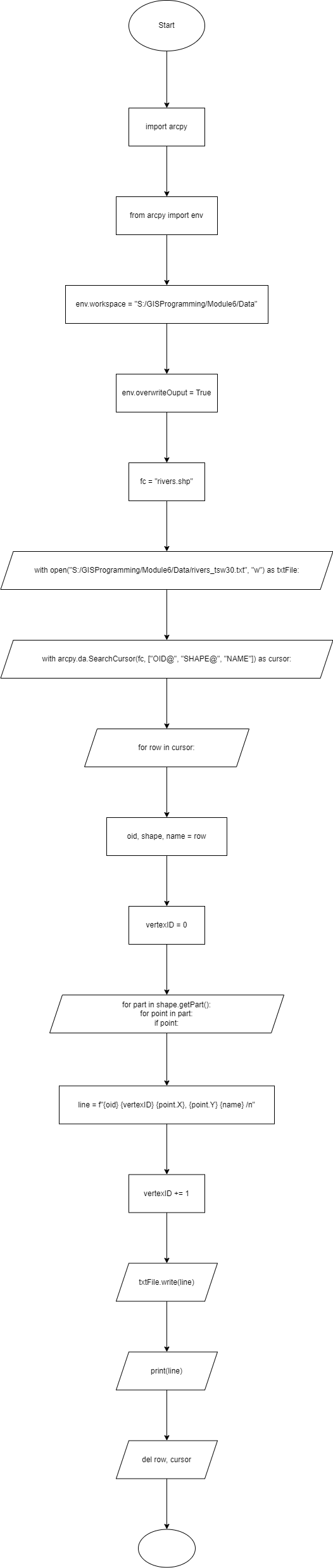
By successfully following this script in the flow chart, you should reach this outcome:

That is all for this class, I can't wait for the next one!
Thanks for reading!


No comments:
Post a Comment